

One pothole.
One photo.
A drawing to work with.
Surface Ops takes measurements from the street to the office. Use a printed marker or a tape measurement as a scale reference; AI proposes the outline and you review it.
In testing · no pilots or customers
Scale matters. Without a reference of known size, a photo is not enough to obtain real measurements.
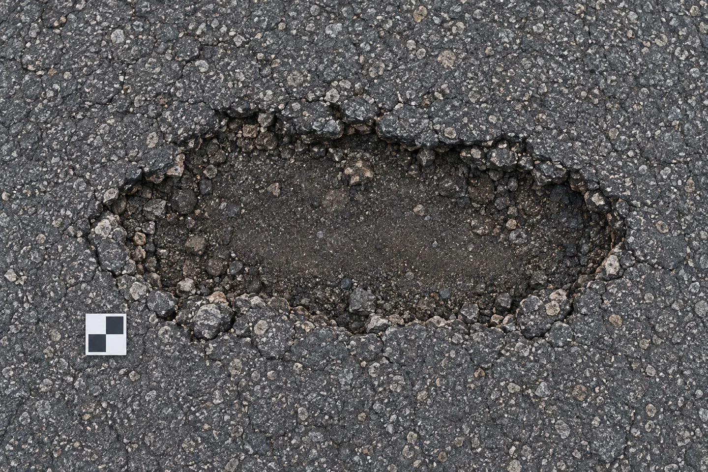
The photo changes.
The work takes shape.
A photo with a scale reference.
Place a printed marker beside the pothole or use a tape measurement. This reference converts pixels into measurements.
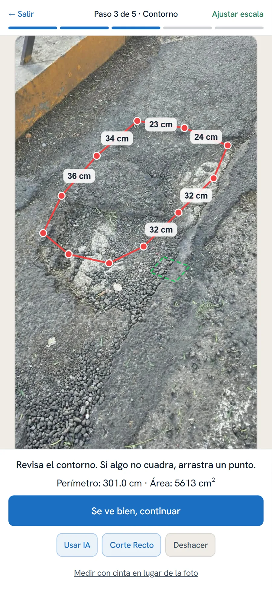
AI proposes; you review.
Select the pothole and adjust the points if needed. The automatic outline can still be wrong.
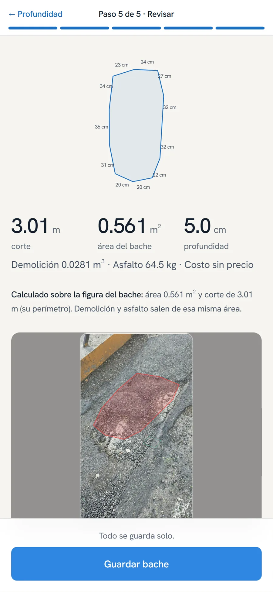
Outline, cut, area and volume.
From the outline to the rectangular cut. Volume depends on the depth used.
- Example rectangular cut
- 1.20 × 0.55 m
AI depth estimation is experimental and has not been compared with an actual field measurement.
A drawing, side by side.
The record shows a drawing with the length of each side. The office can export it to AutoCAD.
View the example dimensions
Follow the outline from A, in the order shown on the plan. These are illustrative measurements.
- A–B
- 0.13 m
- B–C
- 0.16 m
- C–D
- 0.16 m
- D–E
- 0.13 m
- E–F
- 0.11 m
- F–G
- 0.10 m
- G–H
- 0.15 m
- H–I
- 0.11 m
- I–J
- 0.09 m
- J–K
- 0.11 m
- K–L
- 0.12 m
- L–M
- 0.13 m
- M–N
- 0.14 m
- N–O
- 0.13 m
- O–P
- 0.14 m
- P–Q
- 0.13 m
- Q–R
- 0.12 m
- R–S
- 0.11 m
- S–T
- 0.13 m
- T–U
- 0.12 m
- U–V
- 0.09 m
- V–A
- 0.08 m
Review the outline.
The automatic proposal can fail. Adjust the points before continuing.
Check the depth.
AI estimation is still experimental; a field comparison is pending.
Take it to a drawing.
Receive the outline, rectangular cut, area, volume and dimensions for each side.
The office receives
something to work with.
A dashboard with a map, filters and a record for each pothole. Photo, location, measurements and work stages in one place.
Calculated volume and materials depend on the recorded depth. AI estimation is not a field-validated measurement.
The street does not wait
for the signal to return.
Capture and measure.
Record the pothole offline. To use AI offline, download the models to the phone beforehand.
It stays on the phone.
Information is stored locally while there is no connection.
The signal returns; it uploads automatically.
Once the connection returns, records sync so the office can receive them.
For those who work
on the street.
Municipalities
Review locations and organize records coming in from the field.
Construction companies
Bring measurements and drawings into pothole repair work.
Site supervision
Review photos, measurements and stages recorded by the team.
These are proposed uses. Surface Ops is in testing, with no pilots or customers.
Book a trial.
Tell us how your team measures today. Let's review what works, what remains to be tested and whether Surface Ops fits your work.
In testing. We do not offer field-validated accuracy or customer results.